Cyclone Biparjoy slowed down, won’t make landfall before nightfall: minister
By Muhammad JuniadPublished On 15 Jun 2023
ISLAMABAD: Federal Minister for Climate Change Senator Sherry Rehman said on Thursday that cyclone Biparjoy had “slowed down” and will not make landfall before nightfall now.
“Cyclone Biparjoy has slowed down but core remains intense,” she said on Twitter. “It will not make landfall before nightfall now. More information will be shared soon from the National Disaster Management Authority.”
Speaking during a press conference in the federal capital, the climate minister said that landfall of Biparjoy at the Pakistani coastal belt has been delayed as it has been slow down and it is expected that it would hit Keti bandar area of Sindh province at midnight today.
“Since the speed at which it is moving has slowed by 6-7km, its times of landfall is delayed and it is now expected to hit the shores until after dusk.”
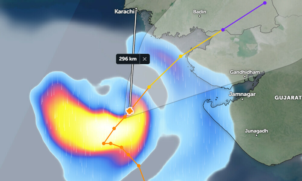
Cyclone has now recurved towards north-east and it is encouraging that it has changed its direction from Karachi, said the climate change minister.
In its morning forecast, the Pakistan Meteorological Department (PMD) said the cyclone was expected to landfall between Keti Bandar and India’s Gujarat by evening.
Maximum sustained surface winds are 120-140 Km/hour with gusts 150 Km/hour around the system’s center. “The sea conditions are phenomenal around the system center with maximum wave height 25-30 feet,” Met Office said.
The Very Severe Cyclonic Storm Biparjoy over northeast Arabian Sea has moved north-northeastward during last 06 hours and now lies near Latitude 22.8°N & Longitude 67.0°E at a distance of about 230km south of Karachi, 235km south Thatta and 155km south- southwest of Keti Bandar.
“Under the existing upper-level steering winds, the cyclonic storm is likely keep tracking Northeastward and cross between Keti Bandar (Southeast Sindh) and Indian Gujarat coast 15 June evening (today) as a very severe cyclonic storm with packing winds of 100-120 Km/hour gusting 140 km/hour”.